Identifying World Heritage Site ‘Attributes of Outstanding Universal Value’
The WHS is defined by seven physical 'Attribute' types (features in the landscape) across the ten separate Areas of the Site - numbered from west to east, A1 to A10 (see the WHS Areas map, above). These seven Attributes are categorised as shown in the list below and each has been given a colour coded symbol to aid their identification within this guidance.
The following photographs show examples of the Attributes to help you recognise them in towns and villages and within the wider landscape. Each Attribute is accompanied by a short description, showing how these relate to the story of historic metal mining in Cornwall and west Devon.
It should be noted that all heritage features that are Attributes of OUV are of equal heritage value within the WHS and all are ‘…of the highest significance’, as confirmed by the National Planning Policy Guidance (NPPG Paragraph: 032 Reference ID: 18a-032-20190723). This significance is regardless of whether these Attributes have any other national or local status, or neither.
Key to the Attributes of Outstanding Universal Value within the World Heritage Site

Mine sites, including ore dressing sites, e.g. East Pool Mine
Mine transport infrastructure, e.g. mineral railways, ports or harbours

Ancillary industries, e.g. engineering foundries, safety fuse works

Mining settlements and social infrastructure, e.g. mineworkers’ cottages

Mineworkers’ smallholdings, i.e. small subsistence farms (often around 3-5 acres in size)

Great Houses, estates and gardens, e.g. Scorrier House

Mineralogical and other related sites of particular scientific importance, e.g. Cligga Head
While some Attributes of OUV within the World Heritage Site will be immediately familiar to many, such as the highly distinctive Cornish-type engine houses found at many mine sites, others will be much less so.
The mining industry in Cornwall and west Devon required considerable infrastructure to operate in the eighteenth and nineteenth centuries and this included that relating to mineral transportation, i.e. the ports and harbours needed to ship the ores and metals to the smelters or end users, and the mineral tramroads, railways and canals, essential to link mines with dock facilities.

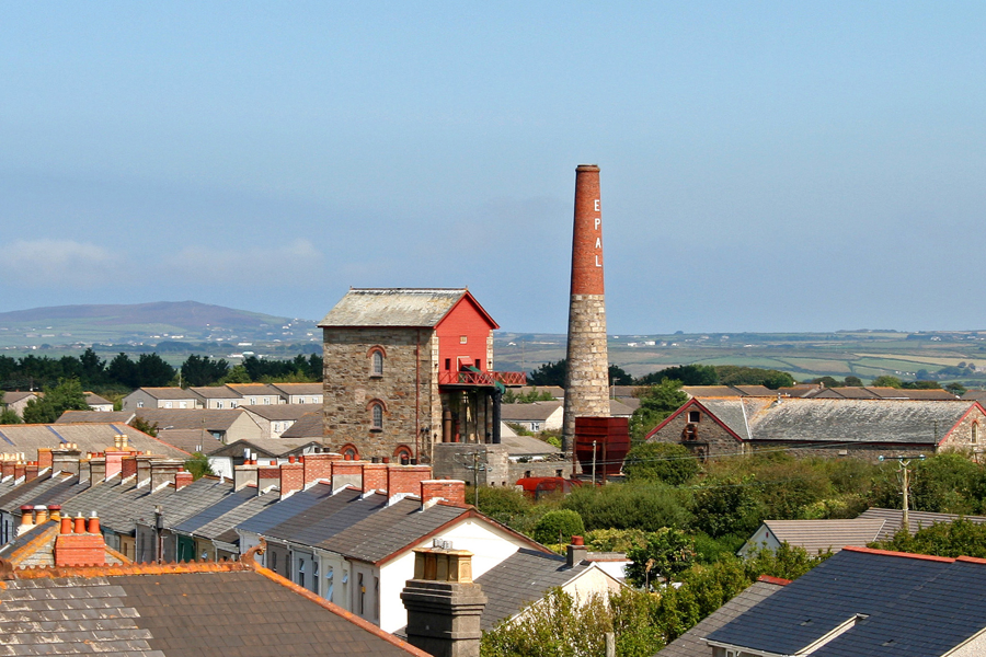
Mining (extraction) and ore dressing (processing) sites are the most obvious features within the historic mining landscape and are often accompanied by one or more of the distinctive Cornish type engine houses. The Taylor’s Shaft pumping engine at East Pool Mine (above), is somewhat unusual in being located within an entirely urban setting but illustrates well the close contextual relationship which existed between metalliferous mine and community.
Transport infrastructure was essential to carry imported coal, supplies and mineral ores to and from the mines. Many ports, harbours, mineral tramroads and railways and, occasionally, canals, were constructed in Cornwall and west Devon for this purpose. Former tramroads and railways are often easily overlooked in the landscape due to their narrow linear nature and the absence of rails or other more obvious features. This section of the Liskeard & Caradon Railway at Pontus Peace (Ponton’s Piece) near Minions, is distinctive in retaining the original parallel granite setts, or bed-stones, which supported the iron rails.

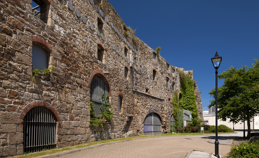
The growth of mining in Cornwall and west Devon fostered the creation of many industries ancillary to mining such as iron foundries and engineering works, gunpowder factories and tin smelters, i.e. industries which were established to service the mining industry or that which processed minerals produced by it. By way of an example, Harvey’s Foundry in Hayle was the leading Cornish engineering works in the nineteenth century and at one time constructed the largest steam pumping engines ever made, many of which were exported via the local port, itself directly created to support the mining industry, to other mines around the world.

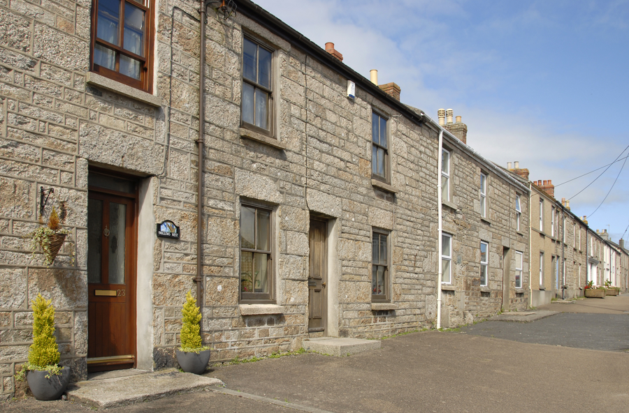
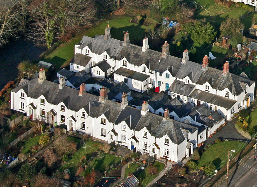
The employment opportunities offered by large scale development in the mining industry led to a rapid population growth and the emergence of new towns and villages with their workers’ housing, Methodist Chapels, public institutes, libraries and shops, etc. Housing was not only built within existing market towns and villages, but also resulted from the establishment of new settlements in the various mining districts, for example Pensilva in the Caradon Mining District (WHS Area A9).

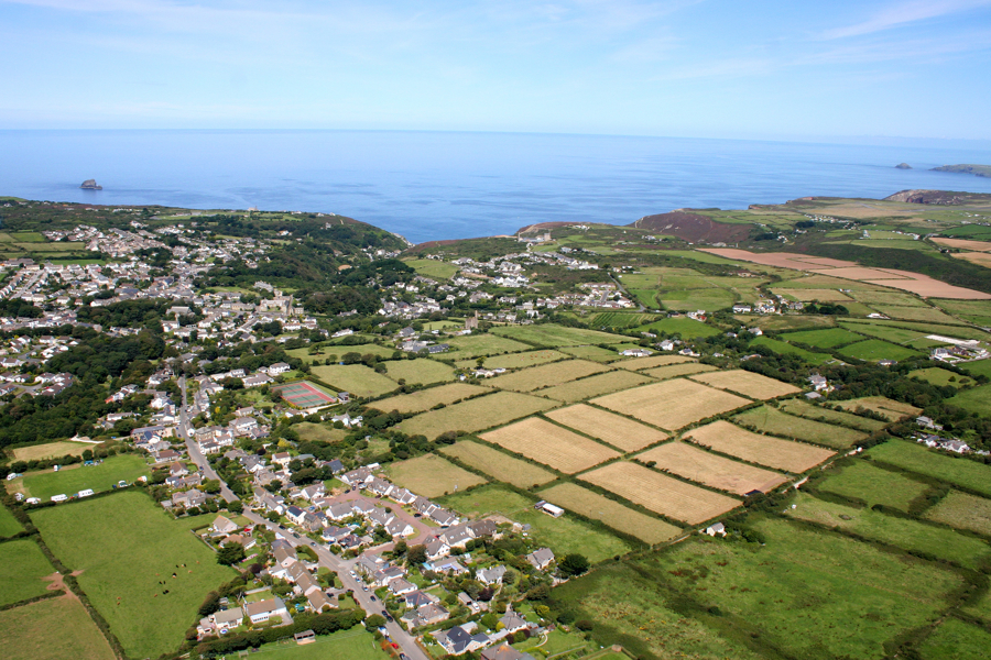
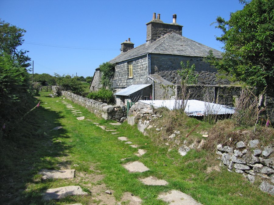
Mineworkers’ smallholdings developed in the mining districts as a response to an increasing demand for land to rear animals and tend crops. These smallholdings, often no larger than two hectares (five acres) in size, consisted principally of often self-built cottages (set within or near to their cluster of small fields – as shown within the blue outline, below) on holdings leased from a landowner. This ‘pig and potato’ subsistence husbandry brought an important degree of self-sufficiency to the mineworker and family, and radically changed the local landscape to create the very distinctive field patterns that are a direct consequence of the mining industry.

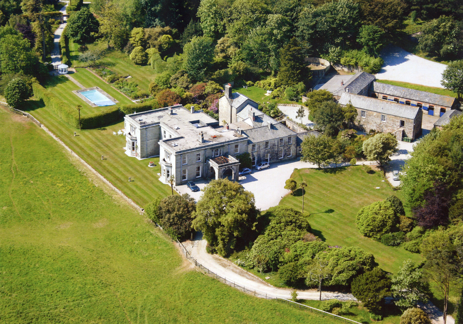
Mining wealth was used by influential landowners (e.g. the Williams family) and shareholders (adventurers) to establish grand estates and gardens, many using specially imported plant species new to Britain.

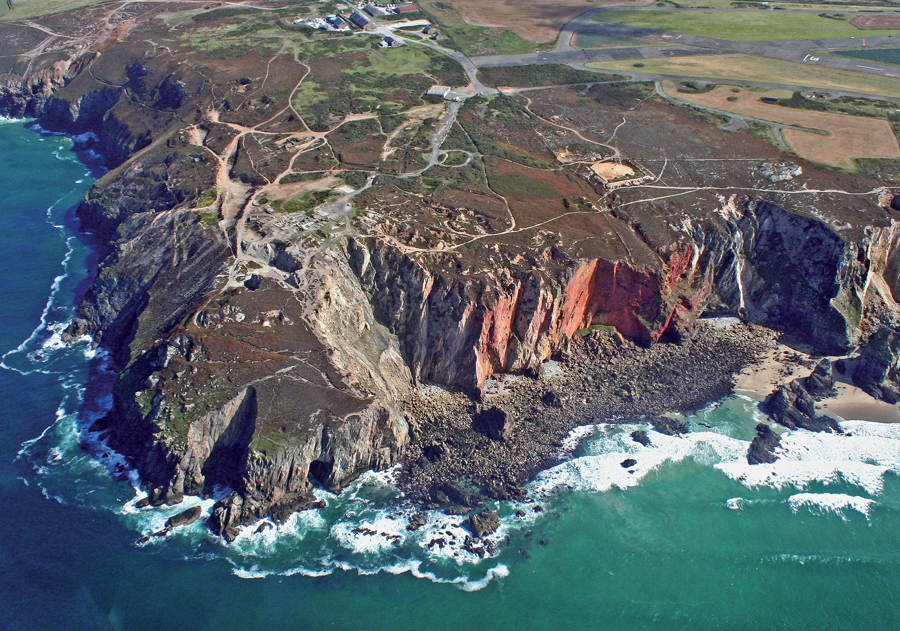
Mineralogy, geology, and the practical application of these sciences to the mineral processing industries were studied extensively in Cornwall and west Devon in the nineteenth century. Key mineralogical sites within the WHS include the discovery sites of new types (species) of mineral, the sources of world-class mineral specimens, and important mineralogical exposures at surface. Such mineralogical exposures, e.g. Cligga Head, below, may be designated County Geology Sites (CGS) or, as in this case, as Sites of Special Scientific Interest (SSSI).