Access for All
We are delighted to have been awarded funding from the Cornwall National Landscape as part of the Access for All grant programme, made possible with thanks to the Defra National Access for All Fund.
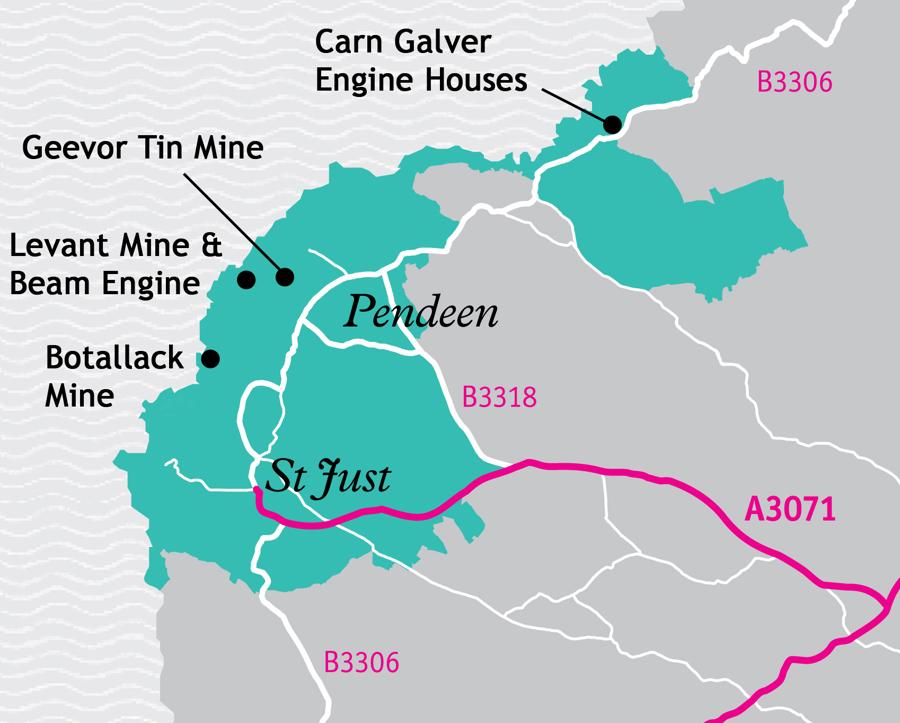
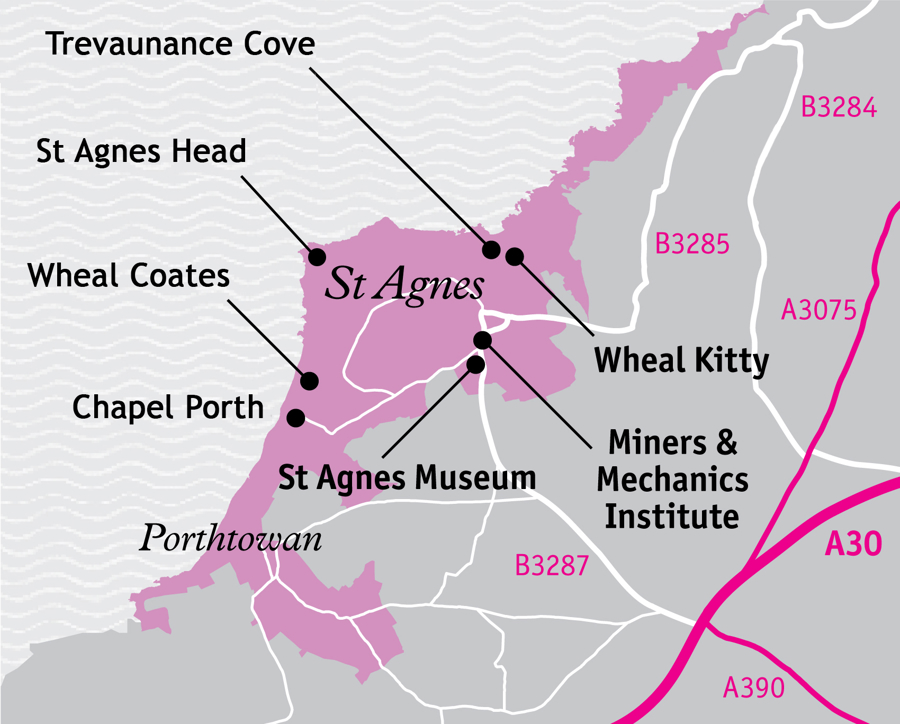
Working with the Sensory Trust we have developed resources to improve access information for visitors St Just Mining District (Area A1), and to St Agnes (Area A7) and Sections 7 and 5 of Cornwall National Landscape. These are places where there is a significant overlap between World Heritage Site and Cornwall National Landscape designations.
Further funding from the Access for All grant programme has enabled us to add resources for the Caradon Mining District (Area A9) which has overlaps with Section 12 of the Cornwall National Landscape.
You can now discover more about accessibility and facilities available in these areas, including some in more remote locations. These resources also suggest alternative sites: for example, if cliff-top mine workings at St Agnes in Area A7 are too challenging, why not try Geevor (Area A1) with parking off the main road and more developed tarmacked areas, or Botallack (Area A1), where a National Trust tramper (all-terrain mobility scooter) is available. If you head over to Caradon Mining District (Area A9) you can visit Liskeard and District Museum to discover the history of the area before heading up to Caradon Hill were you can enjoy the amazing mining landscape from the car or take a stroll around Minions, a village steeped in mining history. They are a great way to plan your next visit to sites where there is Access for All.
If you are heading to Area A10 - the Strolls & Rolls routes in the Tamar Valley National Landscape are a series of stile-free, easy-access walks designed to open up some of the most scenic and nature-rich areas of the Tamar Valley to a wider range of visitors, including those using mobility aids like wheelchairs, pushchairs, and scooters.
Featured Strolls & Rolls Routes include
- Kit Hill – A long history of mining and panoramic views.
- Tavistock Canal – Tranquil waterside stroll along the canal that connected Tavistock’s copper-rich mining areas to the port of Morwellham on the River Tamar.
Each route is:
- Graded by surface and terrain.
- Between ½ mile and 4½ miles in length.
- Accompanied by PDF guides and videos, including OS map links, parking information, nearby facilities, and public transport options.
You can explore all the guides and route details on the Tamar Valley National Landscape website.